

We Are River People
The East Coast may be known for its coastline, but here in New Brunswick, our mighty river systems play an equal part in defining and shaping our lives and culture.

Hello all – today I’m sharing an excerpt from my 2018 book, ‘New Brunswick Underwater’, which tells the story of the historic St. John/Wolatoq River flood and how people up and down the river came together to help neighbours and develop solutions. Please enjoy. Gina and I are off to Port Days today in Saint John.
P.S. Side Walks has its own URL now (yay!). You can find us, bookmark us and share the link with others – www.sidewalksmedia.ca
You can get anywhere in the world by boat from Grand Lake, New Brunswick.
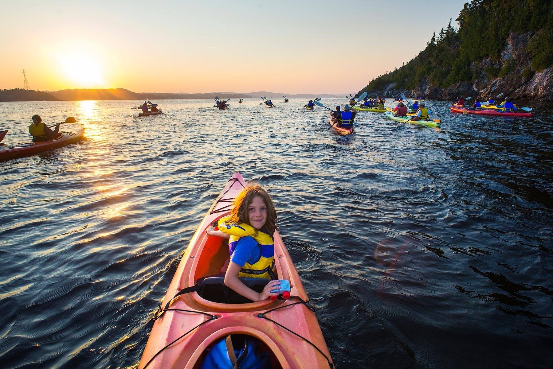
That’s true because of the St. John/Wolastoq River, arguably the most historically and culturally significant river in Canada, a primary transportation route for the movement of animals, people and goods dating back to the last ice age.
The river, which lies within the Appalachian region of North America, is the second largest watershed east of the Mississippi River, surpassed only by the St. Lawrence River, according to the Canadian Rivers Institute, an aquatic science research centre at the University of New Brunswick. In 2011, it published what is still considered the definitive scientific analysis of the river basin, “The Saint John River: A State of the Environment Report.”
The river basin, which includes tributaries, marshes and wetlands that drain into the main stem, covers 55,000 square kilometres, 51 per cent of which lies in New Brunswick, 36 per cent in Maine and 13 per cent in Quebec.
It has nine significant tributaries: the Allagash River, in Maine; the Aroostook River and Mexuxnekeag River, both of which run through Maine and New Brunswick; the Madawaska River, which Quebec and New Brunswick share; and the Green, Tobique, Nashwaak, Oromocto and Kennebecasis rivers, all of which are in New Brunswick.
The lower reaches of the river, which lie below Fredericton, include five major lacustrine (related or associated with lakes) bodies of water: Grand Lake, Washademoak Lake, Belleisle Bay, Long Reach and Kennebecasis Bay.
The river itself is 700 kilometres long, beginning its journey from its headwaters in northern Maine and making its way through three distinct physical geographic regions, beginning with the Chaleur Uplands, known for its rolling hills and valleys. Around Woodstock, N.B., the river enters the Miramichi branch of the New Brunswick Highlands, known for its steep slopes and fast-moving streams. At Mactaquac, the river passes into the Maritimes Plain, the flattest part of the river basin, home to bogs and the basin’s two largest lakes – Grand Lake and Washademoak. As it leaves Washademoak Lake at Hamstead, the river enters the craggy landscape of the Caledonia, or Bay of Fundy, Highlands where it turns and dips its way down to its mouth, which empties into Saint John Harbour via the narrow channel of rapids known as Reversing Falls.
Twice every day the Bay of Fundy fills and empties over 160 billion tonnes of salt water. All that water combined with the unique shape of the bay creates a rocking effect, known as a seiche. It takes about 13 hours for the water to travel to and from the mouth of the Bay near Grand Manan Island to its head in the Minas Basin. At the same time, the Atlantic Ocean’s natural tidal cycle of 12 hours and 25 minutes reinforces the rocking motion, creating the distinctive high tides.
In Saint John, this natural phenomenon is on full display at the Reversing Falls gorge, where the powerful Bay of Fundy tides connect with the mighty Wolastoq/St. John River. Every six hours, as the tide is rising, it sits higher than the river and is able to reverse the river’s flow, creating the famous effect. As the tide goes out, it drops below the river’s level, which resumes its normal course and is allowed to empty into the Bay. At the midpoint of this aquatic tussle is a 20-minute period known as slack tide, when the bay and the river are at equal strength. This is the only time in the tide cycle that boats may pass safely through the rapids.
The tidal effect is so powerful that it can be felt as far as the Mactaquac Dam, 140 kilometres upriver.
Side Walks is fully funded by readers and organizations that support our mission to produce local journalism. If you’re enjoying this story, please consider becoming a paid subscriber, $8/month or $80/year. You can also sign up for a free subscription. All subscriptions deliver Side Walks directly to your email inbox, and you can also read along on the Substack app.
Think of us as your friendly neighbourhood buskers setting fire to complacency while juggling a mix of coverage, commentary and culture – and this is the point in the show where we pass the hat. We appreciate your support!
Now back to the story…
“It’s the most famous entry into the ocean anywhere – and it’s right here. It’s ours,” Molly Demma told me back in 2018. As the then-executive director of the St. John River Society, a non-profit that promotes the wise use of the river’s natural and cultural resources, Molly loved telling stories about the river. Molly died in 2023.
This is a river with many stories to tell. In 2016, archaeologists unearthed an ancient encampment near Fredericton, containing artifacts dating back more than 12,000 years to a time before the river itself existed. The camp was along the shores of a glacial lake that stretched from Fredericton to Belleisle Bay and was likely 10 times the size of Grand Lake. Another site, located at the foot of Bentley Street in Saint John, a stone’s throw from Reversing Falls, contains artifacts that date back 10,000 years, further evidence of continuous human habitation. In fact, most of New Brunswick’s 1,000 known archeological sites date from this time period.
“Think about that,” says Demma. “The pyramids are 5,000 years old. We have 12,000 years of stories.”
The river’s famed birch bark canoe was developed approximately 3,000 years ago to traverse the river and extend Indigenous trading routes, as archeological evidence suggests, including a significant network that extended deep into the Ohio River Valley.
Europeans arrived in 1604 when Pierre Dugau, the Sieur de Mons, and Samuel de Champlain sailed into the mouth of the river to establish France’s land claim in the New World. Champlain named the river “Saint-Jean” to mark the day of their arrival, June 24, the French feast day of St. John the Baptist.
Acadians were the first Europeans to settle in the river valley in the early 1600s. They lived here continuously in small settlements until the mid-1700s, when the Expulsion of the Acadians occurred, resulting in the remaining Acadians either fleeing north or dying at the hands of British soldiers.
As colonial traders, explorers, missionaries, fishermen, soldiers and settlers began to explore and establish permanent residences and fortifications along the river, the rhythm of life for Wolastoqiyik was violently and tragically disrupted. Following the Expulsion, British forces pushed Wolastoqiyik away from the mouth of the river and to places further north, while settlers moved in. Maugerville was the first successful English-speaking settlement on the river, with the arrival of New England planters from Massachusetts in 1763-64.
United Empire Loyalists began arriving en masse in 1784, creating the City of Saint John at the mouth of the river the following year.
Others journeyed up the river to the former French settlement of Pointe Saint Anne, which they renamed Fredericton and declared the provincial capital of the newly created British colony of New Brunswick.
This area was chosen because it lay astride the river and was the furthest ocean-going ships could travel at the time. Fredericton became home to a large garrison because soldiers could travel quickly down and up the river, travelling by water all the way to the St. Lawrence River, connecting the new Maritime settlements with Quebec and Montreal. To the south, people could travel to Halifax, the newly created United States, Great Britain and the rest of the world beyond via the Bay of Fundy and the Atlantic Ocean.
The river’s ability to connect to the world led to the creation of a substantial shipbuilding industry. At its height in the mid-1800s, the Port of Saint John was the largest wooden shipbuilding centre in Canada and the fourth largest in the British Empire. As the St. John River Society describes it, “At the height of the industry, over 8,000 white pines per year were floated down the St. John River to Saint John for use as British navy ships’ masts.”
The river was the primary source of transportation throughout the 1700s and 1800s, first with wood boats, schooners and canoes and then with the arrival of steamboats. It would not be supplanted until the arrival of railways in the late 1800s, followed later by modern highways in the post-war boom.
According to the Canadian Rivers Institute, the St. John/ Wolastoq River is one of Canada’s most disrupted river systems. It has been subject to industrial forestry in its headwaters in Maine, through northern New Brunswick and along its tributaries for over a century. It is home to Canada’s third-largest potato crop, centred around Florenceville, and it has a high concentration of poultry and hog farms.
It is also home to a number of hydroelectric dams and reservoirs, most notably NB Power’s trio of dams along the river’s main stem – Beechwood, Grand Falls and Mactaquac – that have altered aquatic life.
The river basin supports a population of over 500,000 people, the vast majority of them in New Brunswick, living in rural and urban communities the entire length of the river, from Edmundston through to Saint John.
“The grandness and scope of this river can overwhelm us,” says Demma. “It’s just so huge and so vast, and I think sometimes in telling the story of the river, we scale it down to a regional level, to a human level, so we can make sense of it. However, when people have an opportunity to learn about the totality of the river, it fills them with a huge sense of pride.
“It’s like the flood waters flow through all of us. When you boil it all down, we are river people.”
Side Walks Home Page
Catch up on all our stories.